Category:Bishopston, Swansea
Jump to navigation
Jump to search
village and community in Swansea, Wales, UK   | |||||
| Upload media | |||||
| Instance of | |||||
|---|---|---|---|---|---|
| Location | Swansea, Wales | ||||
| Population |
| ||||
| Area |
| ||||
 | |||||
Cymraeg: Pentref a chymuned tua 5 milltir i'r de-orllewin o Abertawe ar benrhyn Gŵyr yw Llandeilo Ferwallt (Saesneg: Bishopston). Mae'r Mwmbwls yn gorwedd dwy filltir i'r dwyrain.
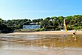
English: The village of Bishopston is situated on the Gower peninsula, some 6 miles (9.5 km) west-southwest of the centre of Swansea in South Wales. Forming part of the Bishopston ward of the City and County of Swansea, it is one of the largest villages on Gower. Bishopston has its own rugby club, South Gower RFC, and its own primary and comprehensive schools. Local beaches include Brandy Cove, Caswell Bay and Pwll Du.
Subcategories
This category has the following 4 subcategories, out of 4 total.
Media in category "Bishopston, Swansea"
The following 170 files are in this category, out of 170 total.
-
 2010 Wales Swansea Community Bishopston map.svg 512 × 472; 632 KB
-
 2024 Wales Swansea Community Bishopston map.svg 512 × 472; 651 KB
-
 A dazzling day at Caswell Bay - geograph.org.uk - 5800406.jpg 3,323 × 2,209; 1.43 MB
-
 A June evening at Brandy Cove - geograph.org.uk - 2447687.jpg 640 × 480; 70 KB
-
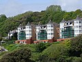
 Apartment block, Caswell Bay - geograph.org.uk - 3626794.jpg 3,115 × 2,020; 1.78 MB
-
 Apartments overlooking the beach at Caswell Bay - geograph.org.uk - 4911166.jpg 6,000 × 4,000; 3.24 MB
-
 B4436 passes a filling station in Merton - geograph.org.uk - 3957126.jpg 3,401 × 2,540; 1.27 MB
-
 B4593 Caswell Road looking north - geograph.org.uk - 4136321.jpg 640 × 481; 92 KB
-
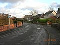 Back of Bishopston - geograph.org.uk - 1108195.jpg 640 × 480; 67 KB
-
 Backinstone Chapel - geograph.org.uk - 3333248.jpg 2,048 × 1,524; 766 KB
-
 Backinstone Chapel - geograph.org.uk - 3333251.jpg 1,990 × 1,566; 1.24 MB
-
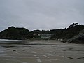
 Beach at Caswell Bay - geograph.org.uk - 4099207.jpg 1,333 × 1,000; 841 KB
-
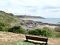 Bench overlooking Brandy Cove - geograph.org.uk - 6222489.jpg 4,000 × 3,000; 2.57 MB
-
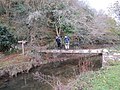
 Bishopston Ford - geograph.org.uk - 6142960.jpg 3,662 × 2,744; 2.5 MB
-
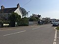
 Bishopston Road - geograph.org.uk - 2212274.jpg 800 × 600; 169 KB
-
 Bishopston Road - geograph.org.uk - 4918733.jpg 6,000 × 4,000; 3.52 MB
-
 Bishopston Road looking north - geograph.org.uk - 4136325.jpg 640 × 481; 70 KB
-
 Bishopston Road, Bishopston - geograph.org.uk - 4576785.jpg 800 × 600; 134 KB
-
 Bishopston Road-B4436 junction - geograph.org.uk - 4136327.jpg 640 × 480; 92 KB
-
 Bishopston Sports Centre direction sign - geograph.org.uk - 6090395.jpg 985 × 1,024; 267 KB
-
 Bishopston Stream descends into a sink hole - geograph.org.uk - 2685585.jpg 1,240 × 800; 185 KB
-
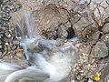 Bishopston Stream disappears into a sink hole - geograph.org.uk - 2685596.jpg 1,024 × 768; 116 KB
-
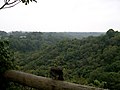 Bishopston Valley - geograph.org.uk - 2053370.jpg 1,024 × 768; 194 KB
-
 Brandy Cove - geograph.org.uk - 4766524.jpg 2,448 × 3,264; 1.84 MB
-
 Brandy Cove Road - geograph.org.uk - 6106768.jpg 2,048 × 1,536; 871 KB
-
 Bristol Channel from the Wales Coast Path - geograph.org.uk - 6222912.jpg 3,837 × 2,879; 3 MB
-

-
 Bus stop on Murton Common - geograph.org.uk - 5831204.jpg 1,600 × 1,200; 747 KB
-
 Caswell - geograph.org.uk - 3842799.jpg 640 × 480; 90 KB
-
 Caswell Bay - geograph.org.uk - 3626423.jpg 3,409 × 1,924; 3.6 MB
-
 Caswell Bay - geograph.org.uk - 3626792.jpg 3,301 × 2,113; 1.51 MB
-
 Caswell Bay - geograph.org.uk - 3626793.jpg 3,349 × 1,875; 1.22 MB
-
 Caswell Bay - geograph.org.uk - 3866699.jpg 640 × 480; 108 KB
-
 Caswell Bay - geograph.org.uk - 4478374.jpg 2,592 × 1,456; 1.05 MB
-
 Caswell Bay - geograph.org.uk - 5800433.jpg 3,323 × 2,209; 2.11 MB
-
 Caswell Bay - geograph.org.uk - 5805694.jpg 3,254 × 1,928; 1.24 MB
-
 Caswell Bay - geograph.org.uk - 6057131.jpg 3,599 × 2,399; 1.37 MB
-
 Caswell Bay Court - geograph.org.uk - 2110059.jpg 1,600 × 1,200; 573 KB
-
 Caswell Bay Court - geograph.org.uk - 5805798.jpg 3,548 × 2,069; 2.1 MB
-

-
 Caswell Bay with a rising tide - geograph.org.uk - 5806069.jpg 3,323 × 2,209; 2.42 MB
-
 Chapel remains - geograph.org.uk - 6106906.jpg 2,048 × 1,536; 1.46 MB
-
 Clyne Common - geograph.org.uk - 1053942.jpg 640 × 480; 102 KB
-
 Coast path approaching Brandy Cove - geograph.org.uk - 4911204.jpg 6,000 × 4,000; 5.12 MB
-
 Coast Path sign at Brandy Cove - geograph.org.uk - 6222478.jpg 4,000 × 3,000; 2.64 MB
-
 Coastline at Caswell Bay - geograph.org.uk - 4478410.jpg 2,592 × 1,456; 1.08 MB
-

-
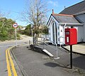
 Copley Lodge bus stop and shelter, Bishopston - geograph.org.uk - 6010966.jpg 1,024 × 596; 158 KB
-

-

-
 Cottages, Pwll Du Bay - geograph.org.uk - 6222927.jpg 4,000 × 3,000; 2.83 MB
-
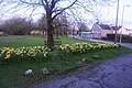 Daffodils on Murton Green - geograph.org.uk - 4919504.jpg 6,000 × 4,000; 4.13 MB
-
 Dark green cabinet, Northway, Bishopston - geograph.org.uk - 6090430.jpg 1,024 × 956; 297 KB
-

-

-
 Entrance to Northway Garage, Bishopston - geograph.org.uk - 5743749.jpg 800 × 522; 117 KB
-
 Ffynnon Murton Green Well - geograph.org.uk - 3757352.jpg 690 × 518; 187 KB
-
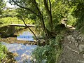
 Footbridge in Bishopston valley - geograph.org.uk - 1820739.jpg 640 × 480; 124 KB
-
 Footbridge near the Bishopston Valley - geograph.org.uk - 2447677.jpg 640 × 480; 143 KB
-
 Footbridge over Bishopston Brook (geograph 7221814).jpg 2,048 × 1,536; 1.72 MB
-
 Footbridge over the Bishopston Stream - geograph.org.uk - 2685572.jpg 960 × 720; 161 KB
-
 Footpath and bridleway - geograph.org.uk - 6106852.jpg 3,264 × 2,448; 4.33 MB
-
 Ford at Pwlldu - geograph.org.uk - 4912760.jpg 6,000 × 4,000; 5.89 MB
-
 Ford behind Pwlldu Bay - geograph.org.uk - 2447731.jpg 640 × 480; 75 KB
-
 Ford in Bishopston - geograph.org.uk - 4918704.jpg 6,000 × 4,000; 5 MB
-
 Fork in tracks - geograph.org.uk - 397186.jpg 640 × 480; 93 KB
-
 From 30 to 20 on The Glebe, Bishopston - geograph.org.uk - 6090375.jpg 1,024 × 901; 236 KB
-
 Gate to a sports field, Murton - geograph.org.uk - 5744842.jpg 800 × 600; 200 KB
-
 Georgian Postbox - geograph.org.uk - 1053954.jpg 480 × 640; 86 KB
-
 Guzzle Hole in Bishopston Valley - geograph.org.uk - 2685624.jpg 1,200 × 800; 251 KB
-
 Hareslade Farm, Gower - geograph.org.uk - 4766514.jpg 3,264 × 2,448; 1.94 MB
-
 Hareslade, Gower - geograph.org.uk - 4766504.jpg 3,264 × 2,448; 1.51 MB
-
 High Tide at Caswell Bay - 1 - geograph.org.uk - 3626374.jpg 3,456 × 2,592; 3.88 MB
-
 High Tide at Caswell Bay - 2 - geograph.org.uk - 3626397.jpg 3,289 × 2,240; 1.71 MB
-
 Houses on Caswell Road - geograph.org.uk - 6213274.jpg 4,000 × 3,000; 2.97 MB
-
 Housing at Murton - geograph.org.uk - 5339835.jpg 3,264 × 2,448; 1.72 MB
-
 Information board, Brandy Cove - geograph.org.uk - 6222482.jpg 4,000 × 3,000; 2.5 MB
-
 Inside the Motte - geograph.org.uk - 1092365.jpg 640 × 480; 480 KB
-
 Into Clyne Common, Murton - geograph.org.uk - 6090443.jpg 1,024 × 596; 250 KB
-
 Joiners Arms, Bishopston - geograph.org.uk - 4918725.jpg 640 × 427; 66 KB
-
-

-

-
 Junction of The Glebe and Northway, Bishopston - geograph.org.uk - 6090352.jpg 1,024 × 656; 172 KB
-

-
 Lime Kiln Lane - geograph.org.uk - 1108182.jpg 640 × 480; 79 KB
-
 Llandeilo Ferwallt Bishopston Church - geograph.org.uk - 3843187.jpg 640 × 480; 104 KB
-
 Llwybr Brandy Cove Path - geograph.org.uk - 3842803.jpg 640 × 480; 137 KB
-
 Llwybr Ceffyl Oldway Bridleway - geograph.org.uk - 3757358.jpg 690 × 518; 248 KB
-
 Llwybr Wernllath Path - geograph.org.uk - 4345653.jpg 640 × 480; 102 KB
-
 Looking south towards the Motte - geograph.org.uk - 1092427.jpg 640 × 480; 123 KB
-
 Mansel Drive, Manselfield - geograph.org.uk - 1053937.jpg 640 × 480; 93 KB
-
 Manselfield Road - geograph.org.uk - 4919808.jpg 6,000 × 4,000; 7.01 MB
-
 Murton boundary sign - geograph.org.uk - 5744786.jpg 800 × 701; 146 KB
-
 Murton Clinic, Murton - geograph.org.uk - 5743938.jpg 800 × 515; 145 KB
-
 National Trust Donation box, Pwll Du Bay - geograph.org.uk - 6222942.jpg 4,000 × 3,000; 2.86 MB
-
 Nature trail boardwalk - geograph.org.uk - 1092428.jpg 480 × 640; 118 KB
-
 North along Murton Green Road, Murton - geograph.org.uk - 5743833.jpg 800 × 502; 116 KB
-
 North along The Glebe, Bishopston - geograph.org.uk - 6090357.jpg 2,226 × 1,613; 932 KB
-
-
 Northern end of Northlands Park, Murton - geograph.org.uk - 6090328.jpg 1,024 × 680; 136 KB
-
 Northlands Park bungalows, Murton - geograph.org.uk - 6090333.jpg 1,024 × 792; 143 KB
-
 Northlands Park, Bishopston - geograph.org.uk - 5743766.jpg 800 × 673; 184 KB
-
 Northway bus stop and shelter near Murton - geograph.org.uk - 6010948.jpg 1,024 × 931; 235 KB
-
 Northway Court, Murton - geograph.org.uk - 6090339.jpg 1,024 × 754; 154 KB
-
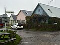
 Northway Garage and shop - geograph.org.uk - 5831200.jpg 1,600 × 1,200; 732 KB
-
 Northway Garage, Bishopston - geograph.org.uk - 5743744.jpg 800 × 485; 103 KB
-
 Ocean Meadows - geograph.org.uk - 4766544.jpg 3,264 × 2,448; 2.32 MB
-
 Oh^ The hand is out again... - geograph.org.uk - 2447724.jpg 640 × 480; 135 KB
-
 Old Kittle Road - geograph.org.uk - 4918712.jpg 6,000 × 4,000; 5.3 MB
-
 Oldway, Bishopston - geograph.org.uk - 1108229.jpg 640 × 480; 63 KB
-
 Oldway, Murton - geograph.org.uk - 5744936.jpg 800 × 622; 132 KB
-
 On the beach at Caswell Bay - geograph.org.uk - 4911175.jpg 6,000 × 4,000; 7.19 MB
-
 On-street parking, The Glebe, Bishopston - geograph.org.uk - 6090388.jpg 1,021 × 1,024; 253 KB
-
 Ordnance Survey Cut Mark - geograph.org.uk - 4511966.jpg 480 × 640; 113 KB
-
 Ordnance Survey Rivet - geograph.org.uk - 4511961.jpg 480 × 640; 74 KB
-
 Overlooking Pwll Du Bay - geograph.org.uk - 1336620.jpg 640 × 249; 30 KB
-
 Path to Brandy Cove - geograph.org.uk - 6213277.jpg 4,000 × 3,000; 2.85 MB
-
 Path to fort - geograph.org.uk - 6106864.jpg 2,048 × 1,536; 1.84 MB
-
 Plough ^ Harrow name sign, Murton - geograph.org.uk - 5744922.jpg 1,063 × 1,591; 279 KB
-
 Primrose bank - geograph.org.uk - 6106888.jpg 3,264 × 2,448; 4.21 MB
-
 Pwll Du - geograph.org.uk - 3842807.jpg 640 × 480; 135 KB
-
 Pwll Du Bay - geograph.org.uk - 6222931.jpg 4,000 × 3,000; 2.9 MB
-
 Pwll Du, Nr Bishopston, Swansea - panoramio.jpg 2,304 × 3,072; 2.04 MB
-
 Pwlldu Bay - geograph.org.uk - 2053374.jpg 1,024 × 768; 170 KB
-
 Pwlldu Bay - geograph.org.uk - 4912744.jpg 6,000 × 4,000; 4.95 MB
-
 Pwlldu Bay, Gower - geograph.org.uk - 2447714.jpg 640 × 480; 107 KB
-
 Pwlldu Pebbles - geograph.org.uk - 796717.jpg 640 × 435; 55 KB
-
 Pyle Road, Bishopston - geograph.org.uk - 4136323.jpg 640 × 480; 69 KB
-
-
 Redcliffe Apartments, Caswell Bay - geograph.org.uk - 5805978.jpg 3,866 × 1,898; 1.69 MB
-
 Retirement Village - geograph.org.uk - 5339834.jpg 3,264 × 2,448; 2.91 MB
-
 Ridley Way... - geograph.org.uk - 1108218.jpg 640 × 480; 117 KB
-
 Road through Eastlands Park, Murton - geograph.org.uk - 5744824.jpg 800 × 568; 82 KB
-
 Road towards Caswell - geograph.org.uk - 1108208.jpg 640 × 480; 90 KB
-
 Ruin at Pwlldu - geograph.org.uk - 6222939.jpg 4,000 × 3,000; 2.84 MB
-

-

-
 St Teilo Church Hall, Bishopston (geograph 6090343).jpg 1,024 × 734; 171 KB
-
 St Teilo's Church, Bishopston-geograph.org.uk-2685557.jpg 1,280 × 960; 237 KB
-
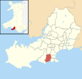 Swansea UK ward location - Bishopston.png 800 × 768; 144 KB
-
 The beach at Caswell Bay - geograph.org.uk - 4911150.jpg 6,000 × 4,000; 4.08 MB
-

-
 The end of the day at Caswell Bay - geograph.org.uk - 5800026.jpg 3,323 × 2,209; 2.12 MB
-
 The Glebe semis, Bishopston - geograph.org.uk - 6090379.jpg 951 × 1,024; 188 KB
-
 The Gower coastline near Brandy Cove - geograph.org.uk - 2447698.jpg 640 × 480; 65 KB
-
 The Valley, Bishopston (geograph 7221396).jpg 2,048 × 1,536; 1 MB
-
 The Valley, Bishopston - geograph.org.uk - 5290158.jpg 2,583 × 1,828; 995 KB
-

-
 Track junction - geograph.org.uk - 6106802.jpg 3,264 × 2,448; 4.14 MB
-
 Tracks to Pwlldu and Southgate - geograph.org.uk - 6106772.jpg 3,264 × 2,448; 3.39 MB
-
 Turning area north of Northway near Murton - geograph.org.uk - 6010936.jpg 1,024 × 687; 208 KB
-
 Unstable sea wall at Caswell Bay - geograph.org.uk - 4911193.jpg 6,000 × 4,000; 5.78 MB
-

-
 Wales Coast Path above Caswell Bay - geograph.org.uk - 4911199.jpg 6,000 × 4,000; 4.98 MB
-
 Wales Coast Path approaching Seven Slades - geograph.org.uk - 4911212.jpg 6,000 × 4,000; 4.31 MB
-
 Wales Coast Path between Brandy Cove and Pwlldu Bay - geograph.org.uk - 6222492.jpg 4,000 × 3,000; 2.89 MB
-
 Wales Coast Path between Brandy Cove and Pwlldu Bay - geograph.org.uk - 6222919.jpg 4,000 × 3,000; 2.9 MB
-
 Wales Coast Path heading towards Pwlldu Bay - geograph.org.uk - 6222496.jpg 4,000 × 3,000; 2.91 MB
-
 Warning sign - minor road junction ahead, Bishopston - geograph.org.uk - 6010957.jpg 1,008 × 1,024; 235 KB
-
 Waymarker and wooden gate - geograph.org.uk - 6106845.jpg 2,326 × 3,104; 3.23 MB
-
-
 White house - geograph.org.uk - 6106806.jpg 3,264 × 2,448; 3.98 MB
-
 White House, Northway, Bishopston - geograph.org.uk - 5743746.jpg 800 × 685; 210 KB
-
 White houses, Eastlands Park, Murton - geograph.org.uk - 5744816.jpg 800 × 516; 88 KB
-

-
 Windowless bus shelter, Kittle - geograph.org.uk - 5831194.jpg 1,600 × 1,279; 853 KB
-
 Woodland primroses - geograph.org.uk - 6106868.jpg 3,264 × 2,448; 3.93 MB
-
 Woodland violets - geograph.org.uk - 6106819.jpg 1,974 × 2,494; 1.75 MB
-
 Late afternoon at Caswell Beach - geograph.org.uk - 409406.jpg 450 × 600; 319 KB


.jpg)


.jpg)


.jpg)


